CLIENT
National Office for Technical Studies and Development (BNETD) of Côte d’Ivoire
SCOPE
Côte d’Ivoire, Abidjan District
TIMELINE
2021 – 2024
The Project for Addressing Roads and Public Places in the Abidjan District (PADA), led by the IGN FI – GEOFIT consortium, is part of PRICI, an ambitious World Bank-funded program aimed at modernizing addressing in Côte d’Ivoire.
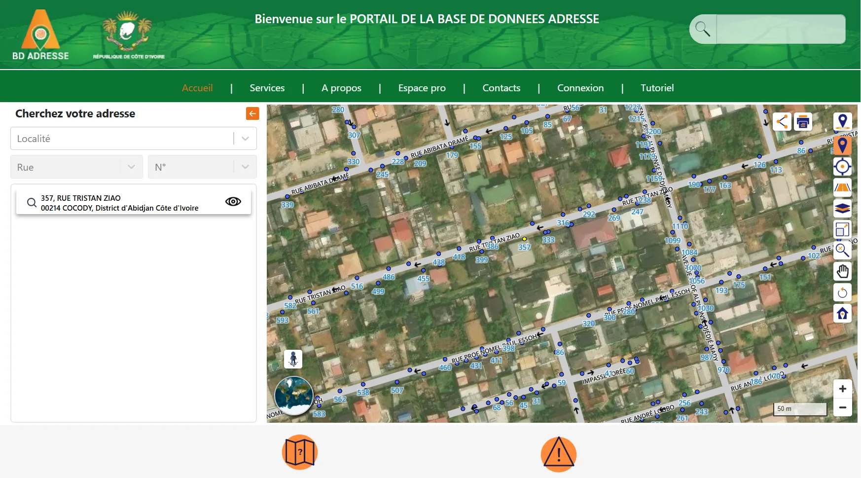
The portal, developed by NEOGEO, is a key tool for centralizing, publishing, and facilitating access to addressing data for citizens, professionals, and institutions. It helps address the challenges of precise location, urban management, and coordination of public services.
public and professional portal
municipalities
roads
Challenges
- Centralization and publication of addressing data in a single reference database, facilitating precise location of occupied units and roads for citizens, professionals, and institutions.
- Thanks to interactive features such as address search and immersive visualization of entrances, the portal improves transparency and access to information while optimizing coordination between public services, network operators, and emergency stakeholders.
- User awareness-raising and simplification of administrative procedures, such as requests for a new address, for more efficient and inclusive urban management.
Missions

Design, development, and deployment of the PADA portal for the general public and professionals
Collaboration with IGN FI and the GEOFIT Group to integrate geographic data and ensure consistency with the PADA project’s overall reference framework
Corrective and evolutionary maintenance ensuring the platform’s availability, security, and performance.
Solutions
Portal developed using open-source components to ensure scalability, performance, and accessibility: https://www.adressage.gouv.ci/
User service features: interactive map with address search and photo viewing, online request for a new address, certificate requests, news area and real-time information, video tutorials