CLIENT
Ministry of Water and Sanitation of Senegal
SCOPE
Senegal
TIMELINE
2021-2024
Controlling urbanization and protecting agricultural land are major challenges for Senegal. The Ministry of Water and Sanitation has launched the Integrated Flood Management Program in Senegal (PGIIS), funded by the Green Climate Fund and the French Development Agency (AFD).
The first phase, covered by this project, aims to centralize and disseminate knowledge on flood phenomena by combining various expertise (historical studies, hydromorphological data, topography, risk zones, rainfall, etc.).
Produced by: IGN FI – BRLi Consortium
portal launched in 2024
pilot zones covering 10,000 km²
flood risk maps
Challenges
The PGIIS project centralizes and disseminates knowledge on flood risks in Senegal, combining various expertise to offer a comprehensive and precise view of the phenomena. Through the implementation of a Geographic Information System (GIS), it facilitates the pooling of reference data and the production of tailored communication documents, even for populations with low awareness.
By strengthening access to information for institutions, the general public, and associated organizations, it contributes to better prevention, reduced vulnerability in exposed areas, and more effective risk governance. Finally, it enables the production of spatial analyses to inform public decisions and optimize flood management.
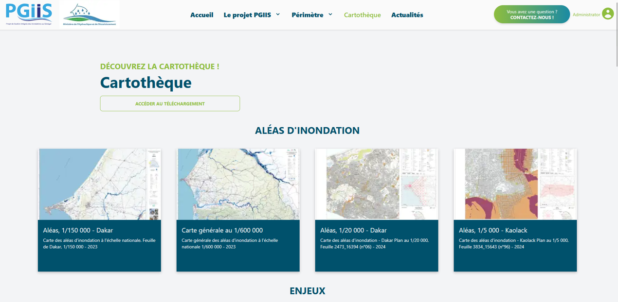
Missions

Design workshops and requirements gathering
Installation and configuration of the OneGeo Suite solution
Integration of geographic data, indicators, and dashboards
Deployment with a Senegalese state hosting provider
Training and skills transfer for local teams
Third-Party Application Maintenance (TMA)
Solutions
Senegal flood risk monitoring geoportal based on OneGeo Suite
Editorial portal (Core), data catalog (Explorer), interactive maps (Maps), indicators, and map library combined in a single interface.
Dissemination and enhancement of flood risk data produced by the project for the territory of Senegal.
Open and scalable architecture facilitating the integration of new datasets and services.
Corrective maintenance ensuring the availability, security, and performance of the platform.
Other references

AREAS OF ACTIVITY
Environment and Risk Management
Anticipate hazards and protect your ecosystems with integrated tools